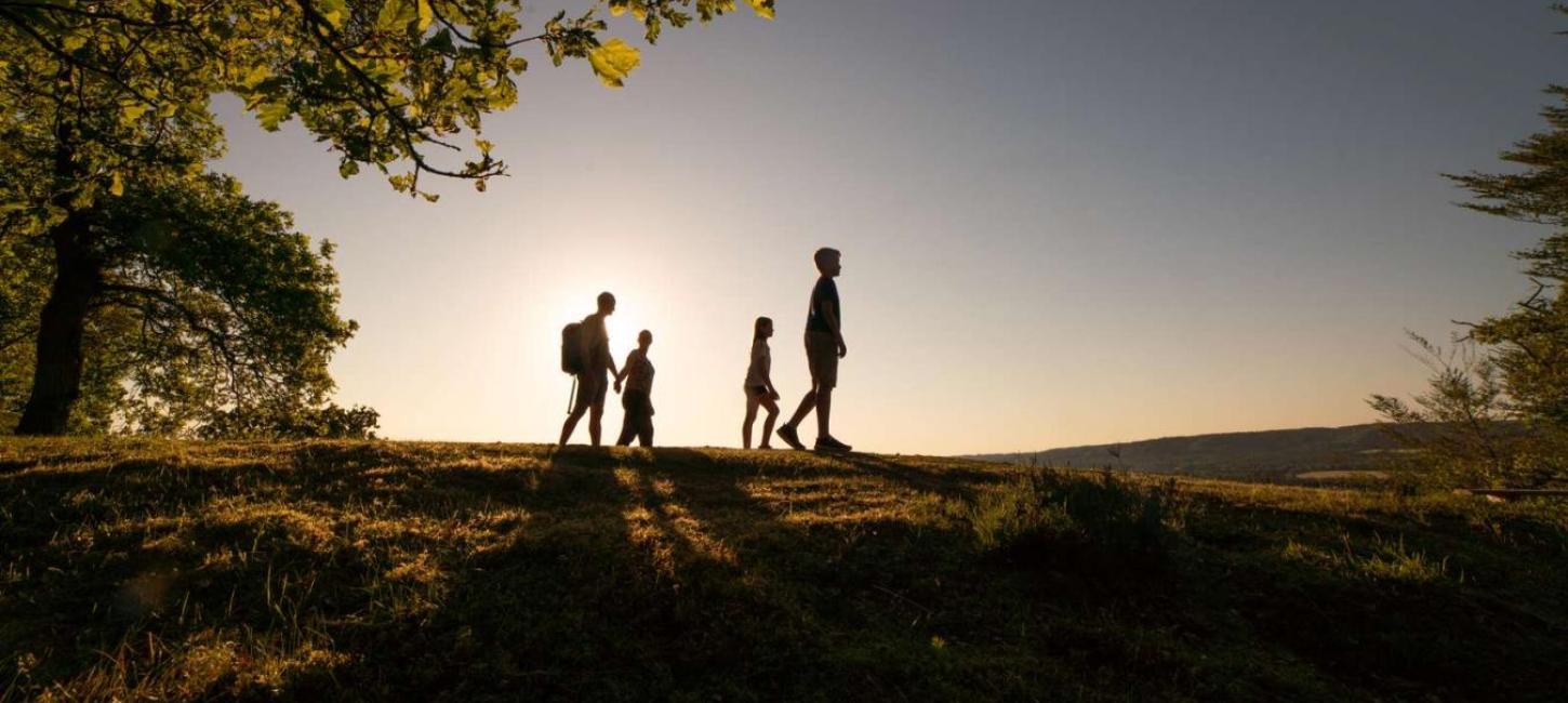
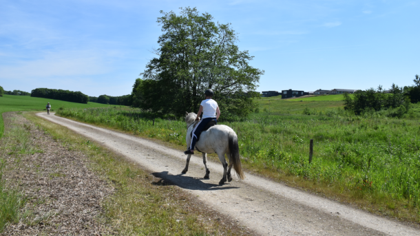
Round trips on foot in Kystlandet
There is a certain comfort in being able to start and end your walk in the same place. When the route goes around the car park, it is easy to get to and from the hiking route by car - without the hassle of having to be picked up or take the bus.
Our best suggestions
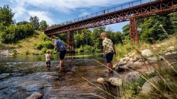
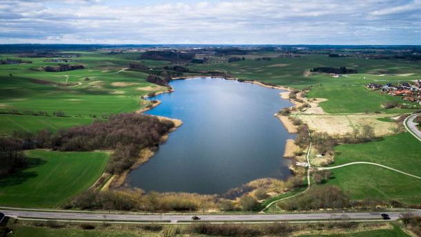
The Uncovered Bridge Route - 10 km
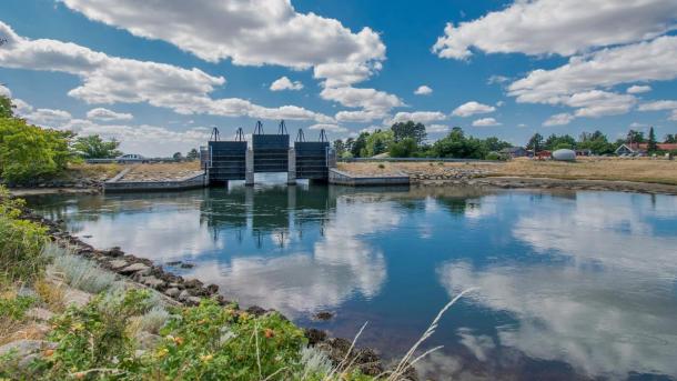
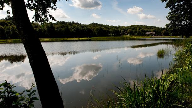
One of Denmark’s most popular nature excursion destinations is the old railway bridge, which crosses the river Gudenåen in beautiful scenery. This tour takes you across the bridge and around the Vestbirk Lakes in the beautiful nature area in Bakkelandet. Part of the trip takes place on the railway trail between Horsens and Silkeborg, and there is parking at the public car park on Vestbirkvej.
The Kanino - 3-21 km
Beautiful Endelave, known for its wild rabbits, offers beautiful nature worthy of preservation and a unique island atmosphere. The Kanino is the name of the signposted hiking route, which goes all the way around the island along the coast. If 21 km is slightly to far, you can choose one of three other signposted routes of 3, 5 and 12 kilometres. All routes start from at the ferry harbour. Parking by the harbour.
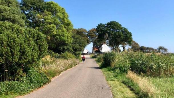
The Hou Coastal Path - 10.3 km
The signposted coastal path at Hou takes you along the fine beaches of the Odder coast from Hou to Hølken Beach and back through the ferry town of Hou. Along the way, there are optimal opportunities to enjoy the summer weather with an ice cream or a dip in the gentle waves of the Kattegat. There is parking in several places in Hou town - including at the official car park for Hou Beach on Villavej and at Hølken Beach.
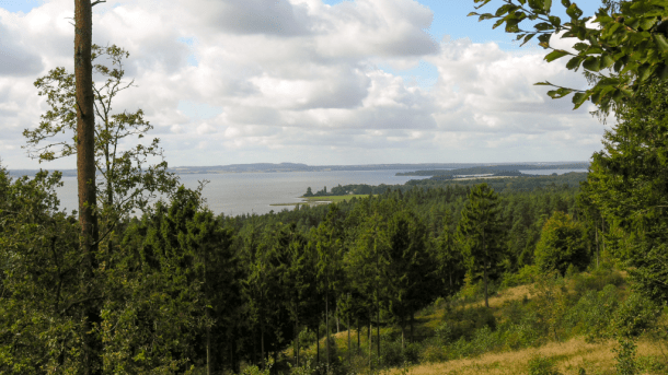
Sondrup Plantage - 8 km
Beautiful hilly forest in the area by Sondrup and Uldrup Hills. The forest offers several beautiful viewpoints - including Blakshøj at an altitude of 74 metres, from where the view of Horsens Fjord is impressive. There are signposted routes that lead around Sondrup Hills (4.4 km) and Uldrup Hills (5.4 km). The two routes are in extension of each other, so you can combine them.
Parking in the car park on Sondrupvej.
Borre Knob - 4 km
Borre Knob is a beautiful natural gem in Horsens Fjord. The elongated peninsula is known by few, but it is possible to take the beautiful walk out to the tip on both sides of the peninsula on the beach and on inland trails. From the tip there is a beautiful view and a good overview of the fjord islands. Borre Knob is known as the peninsula of roses due to the many rose bushes, but there is also forest and a lake here. On the peninsula it is quite peaceful, and there is an opportunity to eat at the packed lunch site on the east side. Parking at the car park at the end of Søborgvej.
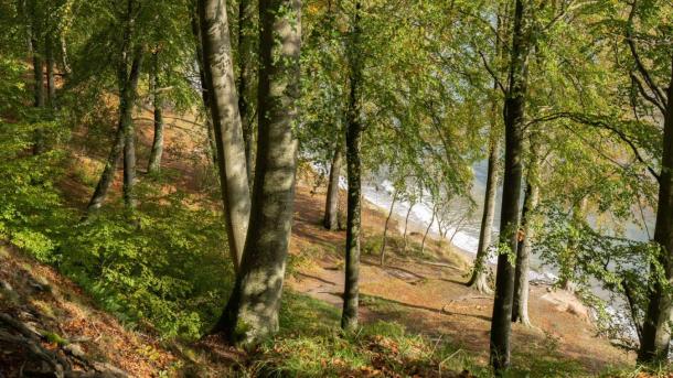
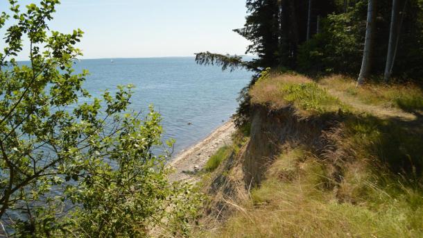
Staksrode Forest - 2.3 km
You will find one of Denmark’s most beautiful forests between Juelsminde and Vejle located right on the coast. Here there are very high slopes, where the trees lie higgledy-piggledy down towards the sea. In the forest, there are three signposted routes between 2.3 and 4.9 kilometres in length. You can encounter the remains of an old castle, and there are three nature campsites - including a uniquely located shelter at the top of the slope. Follow the yellow route for a short, hilly round trip. Parking in the car park at the end of Staksrodevej.
The big watershed - 4 km
The big watershed is more than just the place where the rivers Gudenåen and Skjernåen have their sources. Here there is fantastic nature with forest, meadow and open landscape. In the protected landscape at Tinnet Krat there are several signposted routes. From the car park on Vandskellet road you can follow the red route (4 km) past the springs and through Koutrup Forest, where there are shelters and tent sites. There are also signs for several other short round trips on site. At the large watershed you can also find two of the country’s major hiking routes - Hærvejen and Gudenåstien, which start right here.
Around Bygholm Lake - 7.5 km
Bygholm Lake is one of the Horsens area’s most beloved excursion destinations. The route around the lake goes all the way down to the lake shore in the beautiful, wooded area by Åbjerg Forest. Along the way you will come close to the well-kept graveyard Grønhøj and a campsite with shelters and a playground. There is parking in many places. Among other things, at the car park on Åbjergskovvej at the southwest corner of the lake.
(Klostermølle) and The Sugar Loaf (Sukkertoppen) - 4 km
On the western shore of Mos Lake is a beautiful, unique and versatile nature area. This route takes you from the historic excursion sites The Monastery Mill (Klostermølle) over the distinctive forested hill The Sugar Loaf (Sukkertoppen), which has one of Denmark’s best views, and back again. On the trip you can see Jutland’s largest lake Mos Lake, and you will also pass the large lake area, Klosterkær. Parking at the car park on Klostermøllevej.
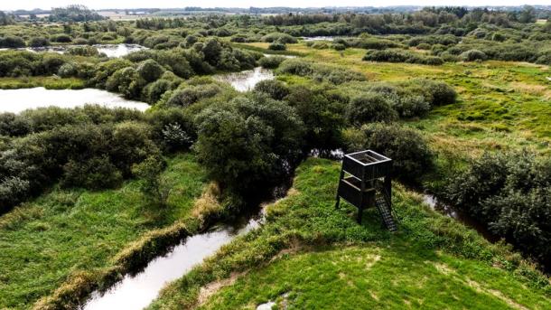
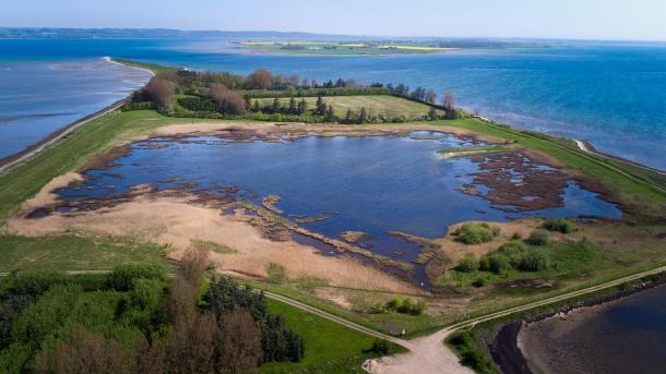
Uldum Marsh - 5 km
Uldum Marsh is Denmark’s largest marsh area. It stretches over 1200 ha, located by the river Gudenåen between Tørring, Uldum and Aale. The area is developed with many paths and roads that make it possible to get around. We recommend a round trip from the shelter site near Uldum to the End of the World and back again. On the trip there are three bird towers and optimal conditions to observe the unique nature and wildlife. There is parking in the car par by the bird tower and shelter on Kærvejen.
Around Bjørnsknude - approx. 5 km
Juelsminde town is surrounded by beach on three sides. From the popular marina you can walk on a lovely path on Storstranden, which leads out to the distinctive tip of the landscape, Bjørnsknude. From here you have a magnificent view of Funen, the Little Belt, Endelave and Samsø. The trip continues on the other side of the tip along Grønbjerggaard Beach. Make the trip a round trip by walking back through the town, or follow Bjørnsknudevej back to Storstranden. Parking at the harbour or in the large car park at Rousthøjs Alle/Juelsminde Strand Camping.
Boller Forest and Klokkedal Forest - 11 km
By the beautiful Boller Castle is an old manor forest down to Horsens Fjord. The castle park and forest are a popular excursion destination for citizens around Horsens with good reason. Combine a tour of the forest with a similar tour of the nearby Klokkedal forest, which is an elongated forest that follows a river through a valley. The walk on the path at the bottom of the valley is one of the most recommendable nature experiences in the Coastal Land. Parking by the car park from Boller Slotsvej or the car park in Klokkedal forest from Bollervej.
Around Tunø - 8 km
Tunø is unusually idyllic and should be experienced by everyone. The trip around the island is 8 kilometres long, and a large part of the way goes along high slopes with a stunning view. The signposted route runs primarily on well-maintained grass trails. And you will not encounter much traffic on the trip. Tunø is car-free. You must therefore park your car around the ferry harbour in Hou. A treasure hunt has been made for children on the trip around the island. Answer the questions correctly and get a medal as evidence.
More suggestions for round trips in forests
More suggestions
The Four Meadows - 7-9 km
On the northwestern outskirts of Horsens is a large meadow area around Store Hansted river. Egebjerg, Hansted, Horsens and Bygholm meadows have in recent years been developed with path systems, bird towers, bridges and raised paths over wetlands. You can park by the lay by area at Skanderborg and go for a round trip of approx. 7 kilometres, where the trip goes back on the Horsens-Silkeborg Nature Trail through the area of Horsens Golf Club. You can also park at Scandic Opus Horsens on Egebjergvej and extend the trip along the river through Horsens Meadow and Løvhøj Forest.
Norsminde - around Kysing Næs - 3 km
The beautiful small harbour town at the entrance to Norsminde Fjord offers a maritime atmosphere and great places to eat. This tour takes you through the harbour environment and around the small headland on the south side of the fjord along grass paths. Parking by the harbour.
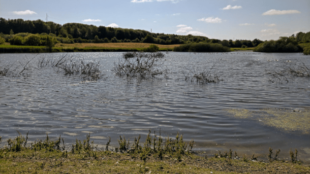
The Hedensted Lakes - ca 4 km
The Hedensted Lakes are a new recreational area on the western edge of Hedensted town consisting of seven smaller lakes. Around the lakes there are trails and footpaths that make it possible to get around each lake. There is a toilet building, packed lunch site, disc golf course, and a campfire hut with shelters in the area. Follow the signs to the Hedensted Lakes from Årupvej. There are signs for parking along the gravel road.
The treatment paths (kurvejene) at Vejle Fjord - 1.5-2.4 km
At the beautiful old sanatorium south of Stouby, which today serves as one of the country’s best spa and wellness hotels, lies a breath-taking park on the edge of the forest with old historic hiking trails. The treatment paths were once used to treat tuberculosis patients. Today, they are publicly available to all. There are four signposted treatment paths, each with its own colour, 1.5-2.4 kilometres long. For example, take the trip up the spiral-shaped snail hill, to Træskohage lighthouse, through the forest and down to the jetty by the small beach. Parking at Hotel Vejlefjord on Sanatorievej.
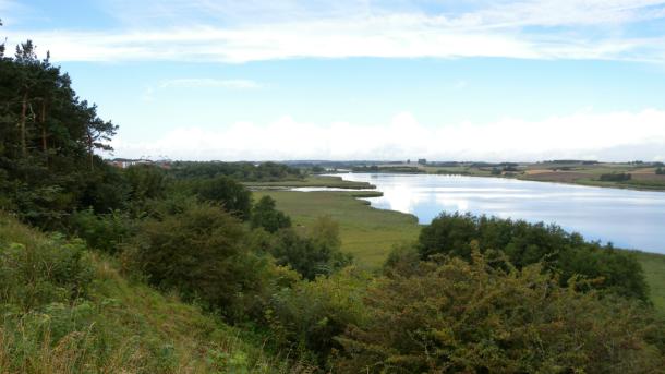
Nørrestrand - Approx. 9 km
In the immediate extension of the four meadows to the east, the Nørrestrand wildlife reserve is located on the northern outskirts of Horsens town. Nørrestrand is a larger freshwater lake and river delta with fine path connections. On the south side of the lake is a lower and an upper path. We recommend a tour on the south side of the lake based on the two trails. On the lower path is a larger bird tower with an excellent view of the area. Parking at the car park at the start of Nordre Strandvej at the western end of Nørrestrand.
Around Ring Lake - 2.5 km
At Brædstrup is this fine lake with a beach and jetty. There is a footpath around the lake that runs through the generally agricultural land, quite close to the shore of the lake. The trip can be combined with a round trip in Ring Forest, The Heart Path (Hjertestien) in Brædstrup or a walk in the town centre that has a surprisingly good shopping facilities. Parking in the car park at Søkildevej.
Pinddal Marsh - 4.3 km
The valley of Pinddalen is located between Voervadsbro and Klostermølle in the southern part of Søhøjlandet in Højlund Forest. It is quite peaceful in the characteristic forest landscape with several lakes and bog holes with high slopes, hills and lots of ferns. A yellow, signposted route leads around the forest, which is an extension of the Voervadsbro-Emborg Gudenå river path. You can combine the trip with the nearby Monastery Mill (Klostermølle), The Sugar Loaf (Sukkertoppen) and The Monastery Marsh (Klosterkær). Parking in the car park at the corner of Klostermøllevej and Grønskovvej.
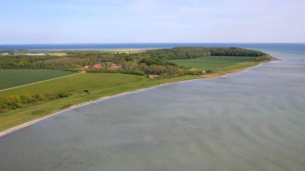
Gyllingnæs - 9 km
Take the trip out to the tip of the large Gyllingnæs peninsula. This trip goes along the west coast of the peninsula from the ford, which is located at the end of a small gravel road. The trip is primarily on the beach, and along the way you will pass the lovely peninsula’s beautiful manor house. The last stretch of way out to the tip of the peninsula, Kalsenakke, you walk along Kalsehoved forest. On the way back you can go inside the forest for the sake of variety. It is not possible to continue the trip along the east coast. Parking at Vadegrunden.
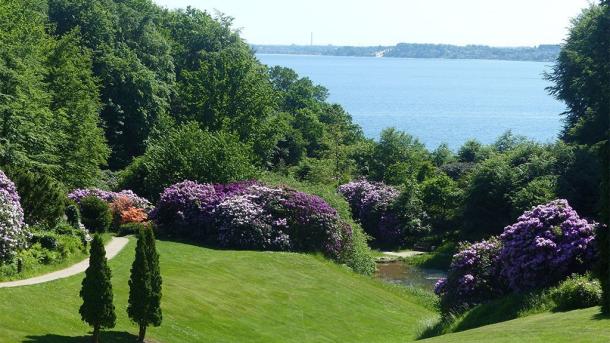
As Hoved - 8 km
As Hoved is a significant tip in the landscape on the coast between Snaptun and Juelsminde, which is known among sailors and fishermen. The area is characterised by a forest with fine trails, and a high slope down to the sea. Park the car at Palsgaard Slotspark on Palsgaardvej and walk the the beautiful manor alley to the forest. You can combine the trip with a visit to the castle park, which is among the most beautiful and largest in Denmark
Hjarnø - 7 km
The cosy island of Hjarnø is quite close to the mainland, only 5 minutes by ferry from Snaptun. There is no actual hiking trail on the island and it is not possible to walk all the way around, but you can have a good round trip by walking along the coast on the south side and through the town back. Do not walk on the northern coast which is a breeding area for birds. Parking in Snaptun or at Hjarnø Church on Østre Kirkevej.
Sebberup Forest - 3.3 km
Immediately north of Hedensted and east of Løsning is Sebberup State Forests. The new forest from 1995 offers varied terrain with clearings, lakes and plains. A signposted route around the forest of 3.3 kilometres leads you around on alternating gravel roads, forest trails and footpaths. There is a cosy shelter site on the route. Parking at the entrance from Remmerlundvej.
Purhøj - 2.8 km
From the top of the Purhøj viewpoint at an altitude of 120 metres, there is a fantastic view of Horsens and Horsens Fjord. On this short hike you walk the steep hike to the top and down again along country roads and gravel roads. Parking by the car park on Purhøjvej near the top.
Torsted Meadow Lake (Engsø) - 1 km
New recreational area south of Bygholm Lake in the southern part of Horsens. In the large fenced area there is a signposted footpath that leads around the lake. There are also a number of grazing sheep in the area, which is characterised by meadows and pastures. Parking at the corner between Vågøvej and Sandøvej. There is also access to the enclosure from Sverigesvej opposite the allotment garden area.
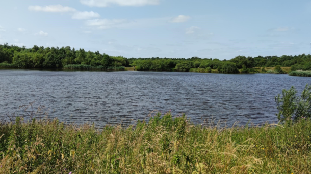
Rørbæk Lake and Koutrupgaard - 14 km
Rørbæk Lake is located in beautiful wooded terrain with protected nature. The lake is not far from the source of the Gudenå river, and we recommend this tour between the sources of the Gudenå and Rørbæk along the south side of the lake. Parking at the source of the Gudenå river on Vandskellet or at Nature Centre Koutrupgaard on Koutrupvej.
Bendixminde - 4.4 km
This trail is actually a bridle path that runs along the new district in Odder, Bendixminde, but it is also recommended for walkers. Part of the trip takes place along Stampmølle Brook, while you also go past Balle Forest and the village of Snærrild. You can extend the trip by 3 kilometres and continue to Odder Centrum along Stampmøllestien.
Around Drossel Marsh - 1.7 km
Northwest of Odder, near Torrlid, is this small lake, well hidden in Nørre Forest. There are several walks in Nørre Forest, but the short route around the lake is less than two kilometres long and is on well-maintained forest roads. In the forest you will find both the highest point and the highest tree in Odder Municipality. Parking on the side of the road on Nørreskovvej.