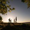
Searching for the best view in Kystlandet on foot
From the tallest hills in Denmark to the long and winding coast. Kystlandet offers many places where the view is certainly Instagrammable. We will guide you to lovely hikes that lead you to places where you can get the best selfie of the day.
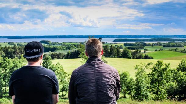
Visit the "alps" of Eastern Jutland
In the soft, hilly landscape, you can find many of the highest points in Denmark. The view varies from forest to lake, city, ocean and vast expanse. But they all offer a spectacular view - and a great hike.
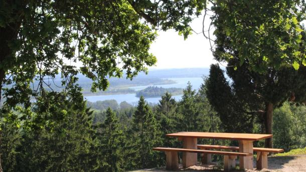
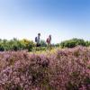
The Sugar Loaf
108 metres asl - 4 kilometres
The Sugar Loaf is not one of the highest points in Denmark but the view is hard to match. From the peak you can see the forest-clad hills of the southern part of The Danish Lakelands. And you also have an excellent view of Jutland's biggest lake, Mossø.
We suggest a hike to the historic picnic spot, The Monastery Mill, at the base of the hill. You will walk through forest on your way to the top and along the monastery canal back to The Monastery Mill, where you can enjoy lunch in historic surroundings. .
Purhøj
120 metres asl - 2,8 kilometer
This characteristic hill is located south of Horsens. On a bright day you can see more than 40 kilometres away - all the way to Aarhus and Æbelø. A lot closer you have a great view of Horsens and Horsens Fjord.
You can park near the top on Purhøjvej and walk a 2,8-kilometre roundtrip, where the highlight is the steep ascent on Purhøjvej (more than 70 vertical metres).
Trustrup Hills
70 metres asl - 1 kilometre
In the hilly landscape of fields and forest on the northside of Horsens Fjord, you can witness a splendid view. You can park at the small parking lot at Glibingvej and enter the enclosure, where goat tracks will lead you around for about one kilometre.
We recommend that you combine this route with Blakshøj nearby.
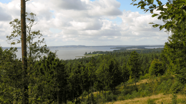
Blakshøj
74 metres asl - 5-10 kilometres
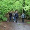
Blakshøj is located in Sondrup Plantation where you can have a great view of Horsens Fjord between the crowns of the trees. Sondrup/Uldrup Hills is one of the most beautiful forest areas in the region with lots of paths through hilly landscape.
We recommend that you explore the area by combining the routes of Sondrup and Uldrup Hills. This is a 10-kilometre walk of scenic beauty. You can park on the small parking lots on Sondrupvej or Vads Møllevej.
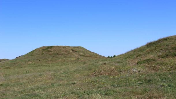
Yding Skovhøj
172 metres asl - 4 kilometres
Yding Skovhøj is Denmark's highest point, if you count the mounds on top of the hill. You will not get closer to the sky in the Danish nature. You can park at the parking lot on Skovhøjvej and follow directions to the top. You can do a roundtrip on the streets Yding Rode and Vistoftevej and back to the parking lot of approx. 3,5 kilometres.
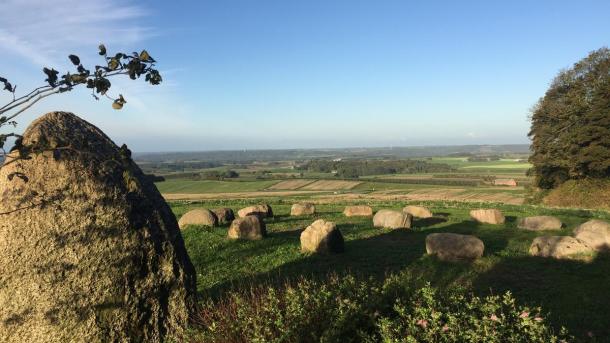
Slaggård Banke
109 metres asl - 2,8 kilometres
In the elevated landscape of Slaggård Banke, southwest of Østbirk, you will find a unique landscape characterized by a large number of burial mounds. A goat track takes you on a 2,8-kilometre roundtrip in nature. You can combine this with a roundtrip through the nearby Vorbjerg Hills, which is also covered by burial mounds. There are 20 burial mounds along the two routes.
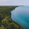
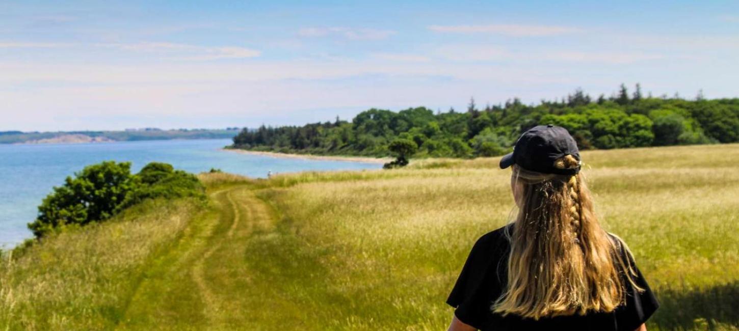
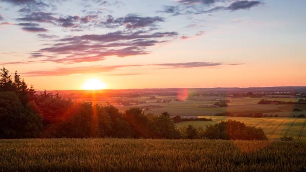
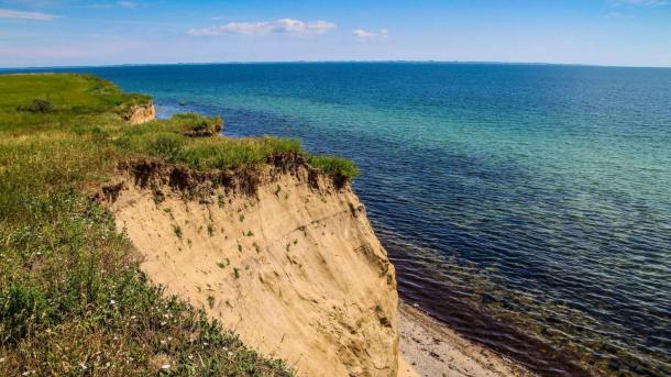
The most beautiful coastal views
The Danish east coast is winding with many bays, peninsulas, and islands. This also means that there are many places where you have an excellent view of the ocean. Vi guide you to hikes at the coast that lead to places where the view is amazing.
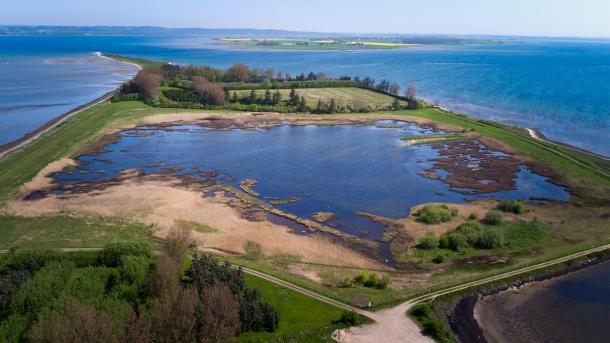
Borre Knob
4 kilometres
This narrow peninsula on the southside of Horsens Fjord stretches a long way into the fjord, almost all the way to the islands Alrø and Hjarnø. At the end, you have an impressive view of the islands, the fjord and the city of Horsens. You can see many boats and ferries sailing close by through the channel. You can park at the conference centre Borre Knob and go for a roundtrip at the beach on both sides of the peninsula.
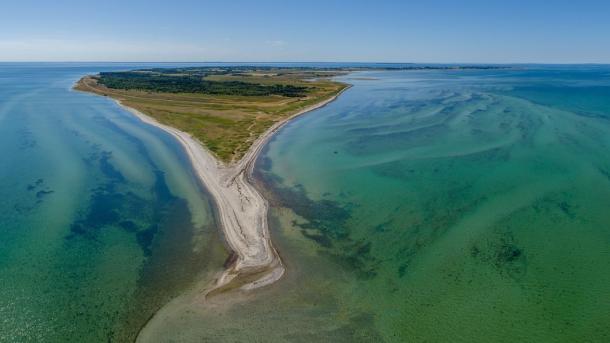
Bjørnsknude
5,5 kilometres
You can find this peninsula in the holiday area of Juelsminde. Park for free at the lively marina and follow the path along the beach Storstranden to the end of the peninsula, from which you can see Vejle Fjord, Little Belt, Endelave, Samsø, Funen, and Æbelø. If you wish, you can walk back on the other side on Strandhuse Beach, and through town - or you can go back the same way as you came.
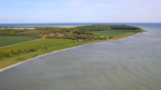
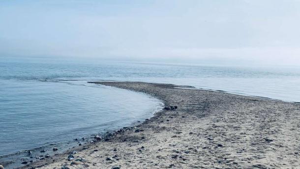
Kalsenakke
9 kilometres
The large peninsula Gyllingnæs serves as a significant delimitation of Horsens Fjord. The area is not overcrowded with tourists, and there is no path leading to the end, but it is a beautiful hike along the narrow west-facing beach nonetheless. At the end of Gyllingnæs, you have Horsens Fjord on one side, and the Kattegat sea on the other. Kalsehoved Forest is at the end of the peninsula, and you can walk through this as you make your way back to the parking lot.
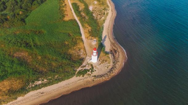
Træskohage
2,4 kilometres
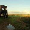
On the northside of Vejle Fjord, south of Stouby, Træskohage offers a great view of the fjord. The beautiful Træskohage Lighthouse, and you can make your way up the stairs and see everything from above. Park your car at Hotel Vejlefjord and walk through their scenic park with historic treatment paths. The yellow route is 2,4 kilometres long and follows the coast through the park to Træskohage and back to the hotel through forest.
As Hoved
8 kilometres
An old manor avenue starting at Palsgaard Castle, leads to the forest on As Hoved Peninsula. On a roundtrip through the forest, you will get to see the slopes at the end of the peninsula. Park your car by the castle park on Palsgaardvej - and you might consider going through the beautiful park.
Øverste Ende
12-21 kilometres
The island Endelave offers several lovely vista points, but the best one is probably at the northern end of the island. Endelave's popular hiking route, The Kanino, that goes all the way around the island, and its little brother, The Mini-Kanino, both take you to the north through the lovely nature area, Øvre. On the long route, you will also pass the southernmost point, Lynger Hage, the slope Klinten and the western end, Kloben. Park at Endelave Harbour or on the mainland at the ferry port in Snaptun.
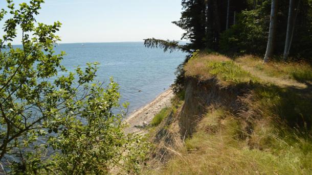
Stenkalven and Revet
8 kilometres
The hiking route around the island Tunø is probably the most beautiful route on this list, based on ocean view. From the western end of Tunø, Stenkalven you can observe the world's oldest wind farm. From the easternmost point, Revet, you can look at the nearby island Samsø. But the most impressive view is probably from the tall bluffs at Sønderklint and Nørreklint. In fact, you have a great view all the way.
Tunø is a car-free island, so park at the ferry port in Hou.