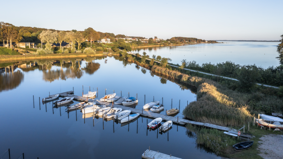
Fjordmino - the Horsens Fjord trail
Discover varied landscapes, unforgettable experiences, and excellent conditions for hiking around Horsens Fjord. The waymarked Fjordmino trail takes you on a 59-kilometre circular walk around the fjord – with help from a couple of charming islands and ferry crossings. Put on your hiking boots and explore forests, fields, beaches, meadows, marinas, and cosy villages along this unique coastal route.
Horsens Fjord is bursting with nature experiences...
… and the new Fjordmino hiking route makes it easy to explore them all on foot.
The winding fjord offers a wealth of natural habitats and a wonderfully varied landscape. Here, you can discover the very best of East Jutland’s nature – all within walking distance.
The route follows the coastline on both the north and south sides of the fjord, with an island-hopping detour via Alrø and Hjarnø. Walk the full trail in one go, split it over several days, or simply choose the section that suits you best. There are also great opportunities for circular hikes based on individual stages of the trail.
Go island hopping on the fjord
Can you walk around a fjord? Not naturally – but with a bit of help along the way, you can! Alrø is connected to the northern mainland by a low dam. From the southern tip of Alrø, a small bicycle ferry sails to the neighbouring island of Hjarnø. From there, you can hop on the Hjarnø Ferry to the charming harbour town of Snaptun on the south side of the fjord.
The Fjordmino trail makes a short stop at Hjarnø Harbour to switch ferries, but we highly recommend taking a walk around the island, which offers rich nature and that special island atmosphere. The Hjarnø Ferry runs up to 30 times a day – just hop on the departure that suits your pace.
Please note: The bicycle ferry operates only during the warmer months – from the Easter holidays to the autumn half-term. See the timetable on this page before booking accommodation.
The northside of the fjord
At the end of the fjord lies the cultural town of Horsens, where a newly developed harbour district welcomes you to the route. You will pass the marina, the lively Langelinie city beach – bustling in the summer months – and its lesser-known sibling, Strandparken. In the district of Stensballe, you walk along a stunning panoramic trail with views across the fjord until you reach the Blue Flag Husodde Beach, where you can enjoy an ice cream from the nearby campsite. From here, the trail continues through the forests of Stensballe and further east through rolling farmland with fjord views most of the way.
Around Sondrup, the landscape becomes more dramatic, and in the Sondrup Hills, you will pass through one of East Jutland’s most beautiful forest areas.
The southside of the fjord
From the harbour town of Snaptun, the trail continues towards Glud. Here, you can visit Glud Museum – an open-air museum offering insights into 350 years of rural life in an area shaped by village farming. Just a few kilometres away, the Ferguson Museum also highlights the region’s strong agricultural heritage.
From Glud, the trail leads through farmland and the villages of Bisholt and Brund, before turning towards the coast. From here, you follow the shoreline all the way back to Horsens.
Alternatively, from Glud, you can head north to the scenic peninsula of Borre Knob, where you can stay overnight at Fjordhotel Borre Knob, and walk along the water’s edge. There is no formal path, but it is possible to walk there when the tide is low. North of Brund, this route re-joins the Fjordmino trail.
You will then pass through the beautiful Boller Forest. Be sure to visit the historic castle gardens at Boller Castle before continuing towards Horsens. The final part of the trail follows the Planet Trail. At the trailhead, you can walk to the end of Boller Pier for a stunning view across Horsens.
Follow the red arrows - and the yellow ones too
The Fjordmino route is waymarked with red arrows and dots. In addition, there are a number of shorter circular loops signposted with yellow arrows. These loops explore nature areas near the main route and include walks in Sondrup Hills, Trustrup Heights, Boller Forest, Klokkedal Valley, Hjarnø, Borre Knob, Stensballe Hills, the Sondrup-Torup Church Path, Amstrup Meadows, Ålstrup, and Bisholt.
Or follow a digital map
With Kystlandet’s digital Fjordmino map, you can follow the route on your smartphone. The main route and side loops are marked in red and yellow, and optional detours are shown in blue.
You can also print the inspiration map and bring it along for your trip.
How far is it between..?
If you want to complete the full Fjordmino trail, it can be done in 2–4 days depending on your daily pace. Use the digital map to calculate distances along the trail. The distances are measured from Horsens, but with a bit of simple maths, you can calculate the length between any two points and plan accordingly.
Experiences and accommodation along the route
Last updated on October 21, 2025 by Casper Terkelsen