The Gudenå Trail: South
Follow Gudenåen through protected natural areas on this signposted hiking route from Tinnet Krat to Uldum Kær. Experience the very special type of nature that characterises this stretch of Gudenåen with meadows, ponds and oak forests and lots of beautiful landscapes.
Hiking on the trail of Gudar
According to an old legend, the demigod Gudar abducted the beautiful Else from her father’s home in Tinnet Krat. During his escape, he steered his horses in sharp turns to confuse his pursuers and in doing so, he created the Gudenå River valley, its meanders, and its name.
In this divine valley, a waymarked hiking route leads you through open scrub and wetland landscapes as well as jungle-like forest. The full Gudenå Trail is 175 kilometres long, while this southern section covers just over 58 km from the source of the Gudenå to Klostermølle.
About the route
Much of the route follows the river, but in places it leads slightly inland, where equally impressive nature experiences await.
This stretch is relatively sparsely populated, but villages are evenly spaced along the route, offering opportunities for supplies and accommodation. The surface varies from natural paths, footpaths, gravel tracks and forest trails to country roads with limited traffic. The route is marked with red arrows and dots.
Experiences along the route
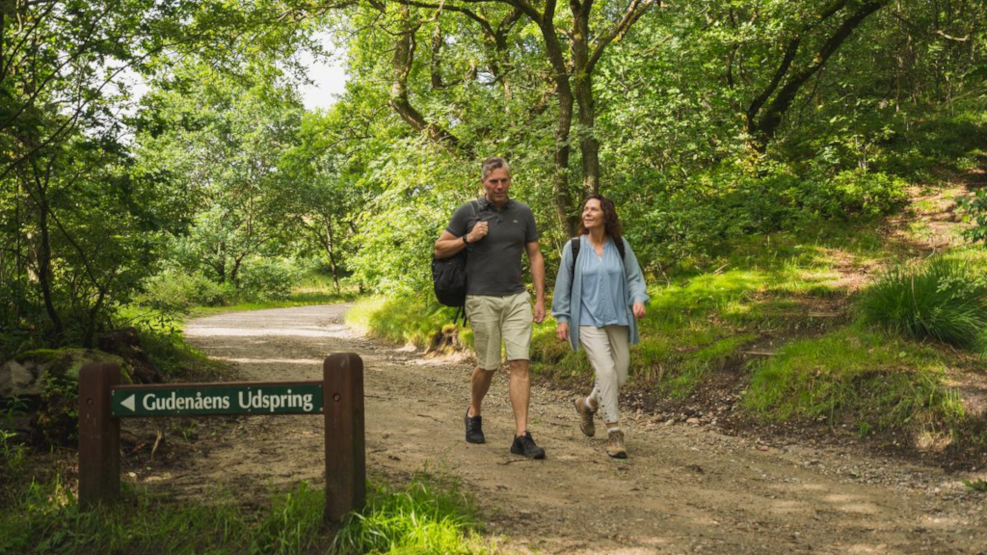
Approximately 10 kilometres west of Tørring, spring water bubbles up from the ground in Tinnet Krat. Here, both the Gudenå—Denmark’s only river—and the Skjern River—Denmark’s most water-rich river—have their humble beginnings.
The so-called watershed and the special natural setting at the source of the Gudenå also serve as the starting point of the Gudenå Trail. In fact, the historic Hærvejen trail also passes close by, making it possible to combine hiking on two of Jutland’s major long-distance routes.
On the other side of Tørring lies Uldum Kær, Denmark’s largest fen area, with a truly unique natural environment and rich wildlife and plant life. In the past, peat was extracted here, but today nature is in charge.
Further north you reach the rolling hill country (the southern part of Søhøjlandet). Here the route crosses The Uncovered Bridge, one of Denmark’s most popular nature attractions. At the northernmost edge of this section lies the old monastery and paper mill, Klostermølle, which today is a major excursion destination with historic buildings on the shore of Jutland’s largest lake, Mossø. Next to Klostermølle rises the distinctive hill Sukkertoppen, from which you can enjoy one of Denmark’s most beautiful views.
Follow the route on a digital map
OplevGudenaa offers a digital map where you can follow the route and see the locations of accommodation, shops, eateries, attractions, and more. You can find it on this page.
On this page, you will find inspiration for more experiences along the Gudenå.
The Gudenå Bus
During the summer holidays, the Modstrømsbus (Gudenå Bus) operates along the Gudenå from Ry to Tørring, stopping at campsites and accommodation along the way. The Upstream Bus is your free option to hike a section of the Gudenå Trail and get transported back to your starting point.
Part of something bigger
Want to hike the entire 175-kilometre route along the Gudenå? Further north, the Gudenå Trail follows the Silkeborg Lakes along the Himmelbjerget Route and continues from Silkeborg to Randers via the Trækstien path. OplevGudenaa.dk is your guide to the full journey.
Find inspiration for more hikes
Kystlandet offers a strong and varied selection of hiking routes of different lengths and through diverse natural landscapes. Get tips for your next hike here.
The full 175 km Gudenå Trail has been realised with support from the Nordea Foundation and the A.P. Møller Foundation.
Last updated on March 30, 2026 by Casper Terkelsen